Dive into New Melbourne Truck Bans to Williamstown Road Curfew

The Melbourne truck bans represent a major shift in inner-west freight management, enabled by the West Gate Tunnel’s opening. The new rules have sparked a debate on balancing community needs with economic efficiency.

The Victorian Government will enforce a night-time and weekend “No-Truck Zone” on Williamstown Road. It recently confirmed the policy will take effect once the West Gate Tunnel opens in December 2025.

Moreover, the decision is part of a broader strategy that includes truck bans on several other residential streets.

Some residents and community advocates praise the move for improving liveability. However, container transport groups criticize it, arguing it highlights a lack of freight planning and could increase congestion and costs on other routes.

New Melbourne Truck Bans Led the New Williamstown Road Curfew

The new regulations designate a section of Williamstown Road as a ‘No-Truck Zone’ during specific hours. The restricted area runs between Geelong Street in Seddon and the West Gate Freeway in Yarraville.

The curfew is in effect during the following times:

  • Weekdays: From 8:00 pm to 6:00 am
  • Weekends: From 8:00 pm Friday to 6:00 am Monday

It is important to note that exemptions will apply for essential deliveries, such as groceries and parcels, to ensure services to residents and businesses continue uninterrupted.

Melbourne Truck Bans, Williamstown Road Curfew
Williamstown Road truck curfew starts next month, banning most trucks on weeknights and weekends. | Image Source: Save Willy Rd

Compliance will not be left to chance; the government will monitor heavy vehicles using smart roadside cameras. These automated systems detect vehicle types and exemptions, fining violators automatically.

New Melbourne Truck Bans Aims to Improve Safety and Liveability

The Victorian government positions these truck bans as a key benefit of the West Gate Tunnel project.

This initiative aims to improve safety and liveability in Melbourne’s inner western suburbs. Its core strategy is to reduce truck traffic on local residential streets.

Roads and Road Safety Minister, Melissa Horne stated, “We are removing a significant number of trucks from local roads across western Melbourne, a key step in improving community safety and liveability.“

Melbourne Truck Bans, Williamstown Road Curfew
Melissa Horne previews tunnel’s “major freight impacts” in address to industry. | Image Source: VTA

According to the government, the West Gate Tunnel offers a more direct route for heavy vehicles accessing the Port of Melbourne. They state this new pathway renders local streets like Williamstown Road obsolete for through traffic.

This move designates Williamstown Road as a No-Truck Zone. It now joins other residential streets like Francis Street and Somerville Road with this same status.

Industry Split: A Win for Residents or a Loss for Logistics?

The announcement has revealed a clear split within the transport industry. It showcases two very different perspectives on the impact of these new rules.

1. A Welcome Change for Community Amenity

The Victorian Transport Association (VTA) has endorsed the curfews. VTA CEO, Peter Anderson described them as a “win-win for residents and freight operators alike”.

Moreover, Anderson argues that the West Gate Tunnel provides a seamless alternative for port access. He states this allows for reduced truck traffic on residential streets while maintaining the capacity to keep Victoria’s economy moving.

Melbourne Truck Bans, Williamstown Road Curfew
VTA CEO Peter Anderson endorses Melbourne truck bans, calling the West Gate Tunnel a “win-win” for residents and freight efficiency. | Image Source: Prime Creative Media

The VTA views the tunnel as vital infrastructure for meeting the future freight task, which is expected to double by 2050. The association also sees the curfews as a way to strike a balance between community amenity and economic prosperity.

2. A Squeeze on an Essential Industry

In stark contrast, the Container Transport Alliance Australia (CTAA) has expressed strong disappointment. CTAA Director Neil Chambers said container transport operators feel “very let down, victimised and demonised even”.

The alliance supported past east-west bans on the condition that north-south routes like Williamstown Road would remain open. They were also promised these routes would be upgraded for increased freight from Brooklyn, Tottenham, and Sunshine.

Chambers contends that the government has failed to act on recommendations from a 2021 corridor study. That study called for upgrades to Millers Road and Williamstown Road to cater for projected 2031 traffic volumes.

What are The Ripple Effects of New Melbourne Truck Bans?

The CTAA warns that the new bans will have significant negative consequences that could extend beyond the transport industry.

The new night and weekend truck bans on Williamstown Road are expected to push heavy vehicles onto the Millers Road corridor.

Moreover, the CTAA describes this corridor as having “dilapidated road infrastructure and traffic-light sequencing” that will not cope with the increased volume.

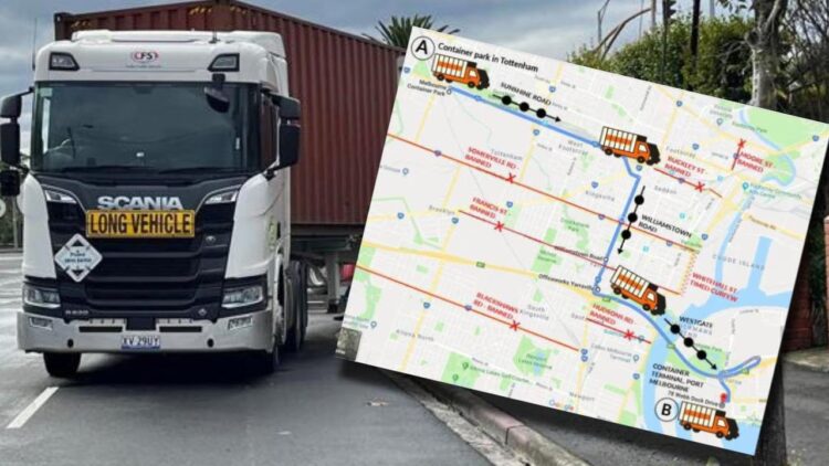
Melbourne Truck Bans, Williamstown Road Curfew
Williamstown Road curfew will push thousands of trucks onto other strained corridors, operators warn, raising costs and congestion. | Image Source: Doublelee/stock.adobe.com

Furthermore, these restrictions compound the financial pressure from new heavy vehicle tolls on the West Gate Freeway. The CTAA has modelled that these tolls could increase container freight costs by 13% to over 30%, depending on the task.

The additional delays and inefficiencies from the Williamstown Road curfew are expected to add to these transport costs.

The industry group cautions that these increased logistics costs risk filtering through to higher prices for food and household goods. This would contribute to the broader cost-of-living pressures facing Victorians.

Here’s How Manage Vehicle Can Help Transport Operators Amid Williamstown Road Curfew

For transport operators and truck drivers, adapting to the new Melbourne truck bans requires more than just rerouting; it demands robust compliance management.

The implementation of automated camera enforcement means that accidentally entering a No-Truck Zone can result in swift fines. This is where a comprehensive fleet compliance management system becomes indispensable.

Manage Vehicle can be a critical tool for navigating these regulatory changes. Its features allow operators to proactively manage their fleet’s compliance with the new rules.

The geofencing capability can be configured to create virtual boundaries around the Williamstown Road No-Truck Zone. This system will then automatically alert drivers when they approach the restricted area during curfew hours.

This real-time fleet compliance system helps prevent costly violations and ensures drivers adhere to the mandated routes. Furthermore, the platform’s route planning and optimization tools can integrate the new bans directly into logistics planning.

Dispatchers can generate routes that automatically avoid Williamstown Road during restricted hours, balancing compliance with operational efficiency.

Manage Vehicle centralizes compliance data and vehicle tracking. This gives operators the clarity and control needed to adapt to changes, minimize disruptions, and protect their bottom line.

See how Manage Vehicle can ensure your fleet’s compliance. Book a demo today.
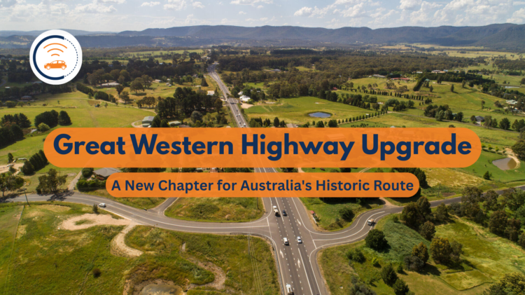
Great Western Highway Upgrade: Rebuild Australia’s Historic Route

Great Western Highway Upgrade marks a significant milestone in the ongoing evolution of this essential transport corridor.

The recent completion of the Coxs River Road Upgrade marks a major investment in safer, more efficient travel between Sydney and regional NSW.

This project demonstrates a modern approach to infrastructure, respecting the highway’s history while meeting today’s transport needs.

The Great Western Highway is Australia’s most historic road. This vital route saved the early New South Wales colony from abandonment and enabled the settlement of the vast western inland.

Since its initial construction by William Cox between 1814 and 1815, the highway has been in a state of continuous improvement.

This evolution spans from Thomas Mitchell’s re-routing in the 1830s to various deviations and upgrades throughout the 20th century.

Today, this 202-kilometre highway remains the key route linking Sydney to the state’s Central West and beyond.

Great Western Highway Upgrade: Project Overview for Coxs River Road

The Coxs River Road Upgrade at Little Hartley represents a $232 million investment in regional infrastructure. The NSW and Australian Governments are jointly funding the project.

This project widened and realigned 2.4 kilometres of the Great Western Highway. The upgrade created a dual carriageway with two lanes in each direction.

Construction began in April 2023. Traffic will switch to the new alignment in April 2025, with final completion and finishing touches in the subsequent months.

New Great Western Highway Upgrade Australia
Construction crews place final pavement layers on the new 2.4-kilometre, four-lane alignment of the Great Western Highway at Little Hartley. | Image Source: transport.nsw.gov.au

The upgraded section stretches from east of Mid Hartley Road to east of Coxs River Road at the foot of the Blue Mountains.

The project created approximately 530 jobs during construction and provided economic benefits to regional communities. It utilized locally sourced materials, including concrete from Lithgow and quarry materials from Oberon.

This upgrade is part of a broader vision to improve the entire Great Western Highway corridor.

However, further planned upgrades between Little Hartley and Lithgow are currently paused, awaiting funding confirmation from both governments.

Key Features and Improvements of Great Western Highway Upgrade

The Great Western Highway Upgrade shows several innovative features designed to enhance safety and traffic flow. The centerpiece is a new 70-metre-long road bridge that carries local traffic, pedestrians, and cyclists over the four-lane highway.

The new grade-separated interchange at Coxs River Road eliminates the long waits for local traffic. This solves a major issue where vehicles faced significant delays trying to join or cross the highway, especially during busy holiday periods.

Coxs River Road Upgrade
Aerial view of the upgraded Browns Gap Road intersection, part of the comprehensive improvements to local access points that enhance traffic flow and safety. | Image Source: ABC News

Other Significant Improvements in the Great Western Highway Upgrade include:

  1. Realignment of the old highway to create service roads for local businesses.
  2. A U-turn bay on Baaners Lane for improved local access.
  3. Over two kilometres of shared paths for pedestrians and cyclists.
  4. New landscaping with native species and retaining walls finished with materials selected by the community.
  5. Variable Speed Limit signage to enhance safety during low visibility and fog conditions.

Moreover, the project delivered critical intersection upgrades at key local roads, including Browns Gap Road, Coxs River Road, Ambermere Drive, and Baaners Lane.

Benefits for Road Users and Community after the Great Western Highway Upgrade

The upgrade delivers tangible benefits for all road users, particularly in addressing congestion and safety concerns.

The Great Western Highway is the major connection between Sydney and the Central West. It carries substantial traffic volumes, including freight vehicles essential to regional economies.

The new four-lane divided section reduces congestion and improves travel time reliability by managing traffic peaks more effectively.

Great Western Highway Upgrade News
Local residents now enjoy seamless access via the new service road, while highway traffic flows freely on the separated four-lane carriageway, reducing travel times for everyone. | Image Source: YouTube, Blackheath Mountain Life

For local residents, the separation of highway and local traffic creates safer access to properties and side roads. The new bridge and shared paths also encourage active transport with dedicated cycling and pedestrian facilities connecting local roads.

Additionally, the diversion of heavy traffic helps preserve Hartley’s historic buildings by reducing constant vibration and rumble from trucks.

Historical Significance in Modern Context

This latest upgrade continues a two-century tradition of improving this vital transport route.

The original Great Western Road was constructed in just six months from 1814 to 1815 under William Cox. This accomplishment helped Governor Macquarie to travel to Bathurst and officially open the western lands to settlement.

Throughout the 19th century, the road underwent significant improvements. These included the construction of Mitchell’s Pass in 1832 and Victoria Pass in the 1830s, which replaced the precipitous descent of Mount York.

Historical Significance of the Great Western Highway Road
The newly constructed divided carriageway at Prospect in 1962 set the precedent for modern upgrades like the Coxs River Road project. | Image Source: Facebook, Michael Lorkovic

The 20th century saw further developments, including the opening of Berghofer’s Pass in 1912. Other key milestones were improvements to Victoria Pass in 1920 and the Lapstone deviation incorporating the Knapsack Viaduct.

More recent upgrades include the bypass of Springwood’s main thoroughfare in 1967. Other key improvements were the opening of Yeaman Bridge at Katoomba in 1985 and the four-lane highway through Linden in 2001.

The Coxs River Road Upgrade represents the latest chapter in this ongoing evolution of the highway.

Community Perspectives and Business Impact

The upgrade has received mixed reactions from different stakeholders.

Government officials highlight the project’s safety and efficiency improvements. NSW Minister for Roads, Jenny Aitchison emphasized that “it is a very busy highway” and that the upgrade “needed to happen.”

However, Member for Bathurst, Paul Toole has criticized the project as a “road to nowhere.” His criticism follows the government’s decision to scrap a planned tunnel between Hartley and Blackheath.

Coxs River Road upgrade of the Great Western Highway
NSW Minister for Roads Jenny Aitchison (Left) and Member for Bathurst Paul Toole (Right) at the site, highlighting the bipartisan recognition of the upgrade’s importance, despite differing views on future stages. | Image Source: Central Western Daily

Local businesses have expressed concerns about being bypassed by the new alignment.

The owner of The Lolly Bug, Sharon Tofler, remains optimistic that her well-known business will continue to attract customers. However, she notes a concern about patrons “finding their way off the highway to get to us.”

Lithgow Mayor, Cassandra Coleman has acknowledged these business concerns and indicated work with the minister on potential signage solutions.

Ready to optimize your transport operations along the newly upgraded Great Western Highway?

The Manage Vehicle FCS app provides advanced route optimization and real-time vehicle tracking. It also includes many more features designed to boost your Australian transport business.

Claim your 20% discount and start a 30-day free trial today to experience how our technology can enhance your efficiency and profitability!

$4.2 Million Investment Boosts Heavy Vehicle Safety Initiative

The Heavy Vehicle Safety Initiative (HVSI) is a cornerstone of Australia’s strategy to improve safety for everyone on the road. The Australian Government funds this grant program, and the National Heavy Vehicle Regulator (NHVR) administers it.

Heavy Vehicle Safety Initiative supports industry-led projects that deliver tangible safety improvements for the transport and logistics sector.

The Albanese Government and the NHVR have made a significant move for road safety. They have just announced a new allocation of funding. A total of $4.2 million will go to 12 new projects under Round 10 of the Heavy Vehicle Safety Initiative.

This latest investment continues the program’s strong track record. Since its inception in 2013, the program has now directed more than $45 million to 181 projects.

The Critical Need for the Heavy Vehicle Safety Initiative

The heavy vehicle industry is vital to the Australian economy. Road freight is expected to grow by 77% between 2020 and 2050. However, this increasing demand also brings unique safety challenges that require innovative solutions.

A sobering statistic underscores the urgency of this mission.

“In 2024–25, sadly we saw 190 lives lost in crashes involving heavy vehicles,” stated NHVR CEO, Nicole Rosie.

She emphasized that reducing fatalities and serious injuries is the NHVR’s number one priority. Furthermore, she stated that there is still plenty to be done.

Heavy Vehicle Safety Initiative Program under NHVR Australia
With 190 lives lost in heavy vehicle incidents last year, NHVR CEO Nicole Rosie announced the urgent mission behind this federal funding has never been clearer. | Image Source: Linkedin, nhvr

The HVSI program also represents a proactive approach to this challenge. As Assistant Minister for Regional Development, Senator Anthony Chisholm, explained,

“By investing in innovative projects that will deliver substantial road safety benefits, we’re furthering our commitment to reduce harm on Australian roads for truckies and all users”.

A Look at the Latest Heavy Vehicle Safety Initiative Funded Projects

The 12 projects funded in Round 10 focus on innovation, technology, and evidence-based material development. Moreover, they aim to address a range of safety issues, from fatigue management to intersection incidents.

Below is a summary of the diverse projects of Heavy Vehicle Safety Initiative that have received funding:

Project Applicant Description
Hold on Heavy SAGE Automation Develops AI to adjust traffic signal phases for approaching heavy vehicles, extending red or green lights to reduce intersection risks.
Interactive Livestock Loading Calculator Australian Livestock, Rural Transporters Association (ALRTA) A web-based tool for transport operators to determine optimal livestock loading patterns and generate compliance reports.
AI-based Fatigue Monitoring System Commonwealth Scientific and Industrial Research Organisation (CSIRO) Develops an AI solution using in-cab cameras to monitor driver fatigue indicators like eye activity and head movements in real-time.
Heads Up Safe Route Swinburne University of Technology Creates technology to identify overhead and at-height hazards in real-time, minimizing collision risks with low bridges or structures.
Compliance Co-pilot National Bulk Tanker Association Inc. (NBTA) An integrated app ensuring safe trailer connections and EBS compliance, providing real-time status checks via a traffic-light dashboard.
FLEETPREDICT: Wearable Fatigue Tech WHG Telematics Pty Ltd Conducts a real-world trial of wearable fatigue management solutions to develop industry guidance and educational materials.
Testing of Rigid Dollys on Roadtrains ARTSA-i Aims to quantify safety benefits of rigid dolly applications in road trains under controlled track conditions.
Preventing Bus Rollaways Bus and Coach Industrial Association Of New South Wales Develops a safety awareness campaign on park brake best practices to prevent bus rollaways.
HVRAP 3.0: Livestock Transport Livestock, Bulk and Rural Carriers Association Incorporated (LBRCA) Develops additional rollover awareness training content specific to livestock transportation.
Motum World Simulated Bus Driver Training Motum Simulation Expands simulation-based training capabilities specifically for the passenger bus driver training sector.
DRIVE S(AI)FE Opposite Integrates AI technology and behavioural science to create a holistic fatigue management intervention.
Safe Electric Trailers and Converter Dollies Tiger Spider Pty Ltd Defines electric trailer and dolly configurations and completes safety tests to establish minimum safety requirements.
Source: NHVR, Heavy Vehicle Safety Initiative (HVSI) program

How the Heavy Vehicle Safety Initiative is Driving Innovation?

While all funded projects show great promise, two in particular highlight the initiative’s push toward intelligent, practical technology.

The “Hold on Heavy” project tackles the high-risk environment of intersections. Moreover, using scalable AI and proven Intelligent Transport Systems (ITS), the technology dynamically detects approaching heavy vehicles.

It can then adjust traffic signal logic to extend a green light, giving a truck more time to pass safely.

If the extension reaches its limit while vehicles are still approaching, it can also flag an extension to the red phase for crossing traffic. This extension is calculated based on the vehicle’s mass and velocity.

Heavy Vehicle Safety Initiative Program in Australia
From intelligent traffic systems that “hold on heavy” to digital livestock calculators, see how new funding is fueling tangible safety solutions. | Image Source: hvia.asn.au

The Interactive Livestock Loading Calculator addresses a very different but equally critical challenge. This web-based tool is designed for use in the field, even in remote areas with limited connectivity.

Transporters can input trip details, vehicle specs, and livestock characteristics. The system then instantly generates accurate loading patterns, axle weight summaries, and compliance reports.

So, this takes the guesswork out of loading, promoting both safety and compliance.

A Sustained Commitment to Safer Roads

The Heavy Vehicle Safety Initiative demonstrates a long-term, sustained commitment to saving lives. The $45 million investment over 181 projects in the past nine years has had “transformative” impacts on the industry.

Heavy Vehicle Safety Initiative Australia
This isn’t a one-off effort. Discover how continuous funding for practical, value-for-money projects is delivering tangible safety improvements year after year. | Image Source: iRap

The program focuses on funding “implementable, value-for-money projects that deliver tangible improvements” to heavy vehicle safety. This ensures that government funding achieves real-world results.

Keep Your Fleet Safer with Manage Vehicle

The government’s investment in projects like AI fatigue monitoring and real-time hazard detection highlights a industry-wide shift towards proactive safety technology. You can bring this same proactive approach to your own fleet operations.

Manage Vehicle helps you enhance truck driver safety and streamline proactive fleet maintenance by providing real-time insights. Our cloud-integrated fleet compliance management system offers:

  • Live Fleet GPS Tracking for improved routing and operational oversight.
  • Real-time Driver Alerting to help combat driver fatigue and distraction on the road.
  • Comprehensive Maintenance Insights to keep your vehicles in optimal condition.

Embrace the future of heavy vehicle safety. Invest in technology that protects your drivers, your assets, and everyone on the road. Sign up today and get 20% off on your first deal with Manage Vehicle.

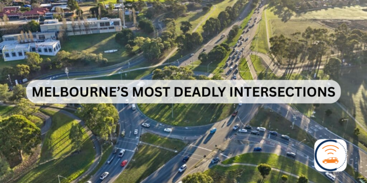
Melbourne Deadly Intersections: A Truck Driver’s Guide for Safety

For truck drivers, navigating Melbourne deadly intersections is a daily challenge that poses a significant threat to both safety and efficiency.

The RACV’s My Melbourne Road campaign surveyed over 12,000 road users. The results identified several key trouble spots across the city.

These locations are notorious for their complex designs, high traffic volumes, and confusing layouts that can lead to dangerous situations, especially for larger vehicles.

Your Guide to Melbourne Deadly Intersections

Before we detail the specific trouble spots, it’s crucial to understand why these intersections are so hazardous.

Experts and drivers identify these intersections where design flaws and traffic patterns create serious risks. So, knowing these spots helps truck drivers defend against danger.

1. North-Eastern Melbourne Intersection:

This roundabout presents a difficult multi-lane challenge on a slope. Also, its poor design often encourages risky and unsafe driving behaviours.

Melbourne Deadly Intersections
North-Eastern Melbourne: from Greensborough Bypass and Diamond Creek Road Roundabout in Greensborough is the most dangerous intersection. | Image Source: Nearmap

2. North-Western Melbourne Intersection:

A complex roundabout forms where Mount Alexander, Keilor, and Lincoln Roads meet. Henceforth, navigating it is made more difficult by turning trams in the busy centre.

Melbourne Deadly Intersections
North-Western Melbourne intersection includes Mount Alexander Road, Keilor Road and Lincoln Road in Essendon. | Image Source: Engage Victoria

3. Western Melbourne Intersection:

The Western Freeway ramps at Hopkins Road feature an unsignalised intersection. Moreover, this design forces conflicting right-turn traffic into dangerous crossing paths.

Melbourne Deadly Intersections
Western Melbourne Intersections from Western Freeway On and Off Ramps at Hopkins Road is one of the most dangerous intersections in Victoria. | Image Source: Moving Melton

4. Eastern Melbourne Intersection:

The junction of Mountain Highway, Wantirna Road, and Boronia Road is plagued by high speeds and difficult turning movements. So, compounding this is its unpredictable traffic signal timing.

Melbourne Deadly Intersections
Eastern Melbourne Intersection is facing issues with high speeds, complex turning points and inconsistent traffic signals made it deadly for truck drivers. | Image Source: Bicycle Network

5. Inner South-Eastern Melbourne Intersection:

Drivers at Dandenong and Warrigal Road face a double threat. Furthermore, the intersection features dangerously short slip lanes and inadequate green light time for right-hand turns.

Melbourne Deadly Intersection
Inner South-Eastern Melbourne from Dandenong Road (Princes Highway intersection is deadly for vehicles to turn right and short slip lanes. | Image Source: Real Commercial

6. Outer South-Eastern Melbourne Intersection:

The complex convergence of Princes Highway, Springvale Road, and Centre Road in Springvale causes severe intersection queuing and low visibility. So, this creates a high-risk environment for all road users and pedestrians.

Melbourne Deadly Intersections
Outer South-Eastern Melbourne from Princes Highway/Springvale Road faces low visibility, over-speeding and deadly for pedestrians. | Image Source: VicTraffic

7. Inner Melbourne Intersection:

The intersection at Flemington Road and Racecourse Road is a major traffic bottleneck. Similarly, drivers must maintain constant vigilance for trams, cyclists, and erratic behaviour from other motorists.

Melbourne Deadly Intersection
Flemington Road creates interaction with trams and bike riders; traffic build-up with driver behaviour. | Image Source: HUON

For truck drivers, the first step to safety is awareness. So, knowing these hotspots helps mitigate the dangers they present.

A Call for Action: Urgent Investment Needed for Safer Intersections

More than 12,000 Victorian drivers voted to name Melbourne’s most dangerous and frustrating intersections. So, RACV is now urging the government to take immediate action.

“We know that around 40 per cent of crashes in Melbourne occur at intersections,” stated RACV Head of Policy, James Williams.

Melbourne Deadly Intersections
RACV Head of Policy James Williams shares insight on regional road intersections in Victoria. | Image Source: 7News Melbourne

Mr. Williams also emphasised that to achieve the goal of halving road deaths by 2030,

“government needs to invest in fixing these intersections.”

Furthermore, RACV has provided evidence-based solutions for these high-risk locations. Fixing them is critical, as Williams notes,

“While improved driver behaviour and vehicle safety technologies are crucial, we will not reach our Towards Zero targets without investing in safer roads.”

The message is clear. Therefore, we need proactive investment to save lives and reduce daily driver stress across Melbourne and regional Victoria.

Here’s How Manage Vehicle Tackles Melbourne Dangerous Intersections

While you can’t change dangerous road designs, you can change how you navigate them. Moreover, Manage Vehicle app empowers truck drivers with smarter tools, using advanced route planning to identify and avoid known dangerous intersections.

Manage Vehicle Software Tackling Melbourne Deadly Intersections
Manage Vehicle Software improves route optimisation and real-time location tracking. | Image Source: Trinetra

Real-time tracking provides live updates on traffic and accidents, allowing for dynamic re-routing away from trouble spots. So, this gives you greater control for safer, more predictable road operations.

Navigate smarter and safer. Start your 30-day free trial of the Manage Vehicle app today.

Sydney Road Maintenance: Navigating Transport Challenges

A $200 million road maintenance blitz is transforming Sydney’s driving experience. NSW Government investment is targeting potholes and road repairs across Sydney, bringing the total 2025/26 maintenance budget to $488 million.

For transport operators, navigating this maintenance is essential for safety, efficiency, and protecting assets.

This maintenance blitz is a direct response to one of Sydney’s wettest winters, which caused severe road damage. The government has already filled over 5,100 potholes since August, highlighting a major problem for transport.

For the industry, this means greater vehicle damage risks, unpredictable delays, and supply chain disruptions that hurt business and customer satisfaction.

Recent Incident Highlights Urgent Need for Sydney Road Maintenance

The consequences of poor road conditions became clear when metal shards shut down the M1. The resulting chaos for commercial vehicles was a stark warning.

The incident occurred around 5am when a truck carrying scrap metal lost part of its load. Thousands of sharp metal pieces were scattered across the M1 motorway between Palmdale and the Mooney Mooney Bridge.

Sydney Road Maintenance Blitz
The reason behind NSW Government’s $200 million initiative are potholes and lack of road maintenance that caused heavy vehicles in causing accidents.

The result was nearly 300 vehicles with punctured tires, creating a 30-kilometre stretch of road closures and traffic tailbacks stretching up to 40 kilometres.

This incident highlights Sydney’s broader road challenges. Hundreds of vehicles suffered multiple tire punctures in a single incident.

For fleets, the severe financial impact extends beyond delays to include costly replacements, vehicle downtime, and missed deadlines.

Key Statistics from Sydney Road Maintenance Program

Maintenance MetricAchievement
Total Maintenance Funding (2025 to 2026)$488 Million
Recent Accelerated Funding$200 Million
Potholes repaired (August to September)5,100+
Road Surface Resurfaced (Previous Year)~1 Million Square Meters
Equivalent Football Fields Resurfaced125+
Data Source: NSW Government, MHD Supply Chain News

Understanding Current Sydney Road Maintenance Challenges

Sydney’s extensive maintenance program is strategically targeting high-traffic and critical freight corridors.

The program prioritizes work based on traffic volume, damage severity, and network importance to maximize impact on vital commercial routes.

Sydney Road Maintenance Challenges
Aerial view of road maintenance crews in orange vests performing asphalt repair and pothole patching. | Source: Infrastructure Magazine

A “perfect storm” of factors has damaged Sydney’s roads, including an 8% traffic increase, major infrastructure projects, and severe wet weather.

For transport operators, this means longer commute times, higher operating costs, and greater scheduling complexity.

Poor road conditions have a substantial economic impact. Surveys show most businesses are affected by congestion, with Sydney companies facing similar challenges.

Delays from roadworks and potholes can deter customers, disrupt deliveries, and directly impact revenue.

Manage Vehicle Software: Strategic Navigation During Ongoing Maintenance

For transport operators, comprehensive fleet management software is the key to navigating Sydney’s road maintenance.

Fleet management software like Manage Vehicle combine real-time GPS tracking, route optimization, and maintenance alerts to maintain efficiency despite poor road conditions.

Manage Vehicle for Smarter Routes and Optimised Locations
Manage Vehicle can assist you with real-time route planning and optimised locations to reach your destination on time.

Manage Vehicle provide multiple benefits during periods of extensive road maintenance:

  • Real-time vehicle tracking that allows managers to monitor exact vehicle locations and respond immediately to disruptions.
  • Route optimization that automatically calculates the most efficient paths considering current traffic conditions.
  • Geofencing capabilities that trigger alerts when vehicles enter or leave designated areas.
  • Driver behavior analysis that identifies practices leading to increased vehicle wear.
  • Maintenance scheduling that ensures vehicles remain in optimal condition despite challenging road surfaces.

Manage Vehicle tackles pothole damage with proactive routing. Its system uses real-time data and hazard alerts to steer drivers clear of road damage, reducing both maintenance costs and vehicle downtime.

Don’t Let Road Maintenance Slow You Down! Get a free trial and see how Manage Vehicle’s real-time tracking and location optimisation can protect your vehicles and your schedule.

Melba Highway Closure: Landslip Repairs Cause Major Delays

Melba Highway closure will disrupt commuters and freight operators for months as major repairs to two landslips are now underway, with the project expected to continue until the end of January 2026.

Earlier this year, from approximately February 17 to the end of March 2025, a section of the Melba Highway was closed due to landslip repairs in Dixons Creek. The affected area was located between Healesville-Kinglake Road and north of Hunts Lane.

During that closure, detours were established to guide different types of vehicles. Light vehicles, rigid trucks, and buses were diverted via Healesville-Kinglake Road and Healesville-Yarra Glen Road.

Melba Highway Closure: Major Landslip Repairs Until 2026

A single lane of the Melba Highway in Dixons Creek will remain closed until the end of January 2026 as crews work to repair two landslips that have caused major damage to the highway’s foundation.

The works, which began on Monday, October 13, are focused on a 130-meter section approximately 3km south of the Healesville-Kinglake Road intersection.

Melba Highway Closure Map
Two landslips have caused a major damage to the Melba Highway. Authorities have told commuters to take another route for travel and work. | Source: DoTP

The repair work involves a multi-stage process to stabilize the road:

  • Excavating and removing the damaged road pavement
  • Building new retaining walls
  • Reinstating and stabilising the road asphalt layers
  • Improving drainage to prevent future issues
  • Reinstating safety barriers, signs, and line marking

Early Works Trigger Melba Highway Closure and Reduced Speed Limits

From Monday, October 13, to Friday, October 31, crews are conducting early works, setting up the site and carrying out excavation and drainage work. During this period, motorists will encounter the following conditions:

  • Lane Closure: One lane will be closed during work hours (7am to 6pm, Mondays to Saturdays) over approximately 100 metres between Healesville-Kinglake Road and Hunts Lane.
  • Traffic Management: Temporary traffic lights and on-site traffic controllers will be in place to manage flow.
  • Speed and Delays: Reduced speed limits are in effect, and drivers should expect delays of around five minutes, with longer waits during peak times. The road reopens to two lanes outside of work hours.
Melba Highway Closure Due To Landslip Repair Works
Melba Highway Closure due to Landslip Repair Works at Dixons Creek; Here’s a Detour Route for Light Vehicles. | Source: Transport Victoria

In a welcome relief for holiday travel, crews will complete early works before the Melbourne Cup long weekend. Both lanes of the Melba Highway will be open from 3pm Friday, October 31, until 7am Wednesday, November 5.

24/7 Melba Highway Closure from November 5 as Major Works Begin

After the long weekend, from Wednesday, November 5, until the end of January 2026, the repair project will intensify. Crews will work on both landslips simultaneously, leading to more extensive traffic conditions.
  • The project will maintain a single lane closure at all times over a 200-meter stretch.
  • Temporary traffic lights will operate 24/7 to manage two-way traffic.
  • Traffic controllers will be on-site during work hours, and reduced speed limits will remain for safety.
  • Drivers should continue to expect delays of approximately five minutes.
Melba Highway Closure Beyond North of Yarra Glen
Previously, two landslips already happened in Melba Highway to close from Kinglake to Dixons Creek in February 2025. | Source: Victorian News

Works will pause for the Christmas and New Year period under changed traffic conditions, with further updates to be provided by the Department of Transport and Planning (DoTP) as the project progresses.

Navigate Highway Disruptions with Manage Vehicle

For transport and logistics companies, unexpected road closures like those on the Melba Highway can cause costly delays and disrupt delivery schedules.

Manage Vehicle app helps fleets navigate these challenges by providing real-time alerts for highway closures and traffic disruptions, allowing for dynamic route optimization.

With features like smarter transport management and real-time tracking, the system guides drivers to the most efficient paths. This saves valuable time and fuel by helping them avoid unexpected roadblocks.

Give your fleet the advantage of foresight. Try the Manage Vehicle app today and transform the way you navigate route disruptions.

Steep Descents in Australia: NHVR Warns Drivers To Be Cautious!

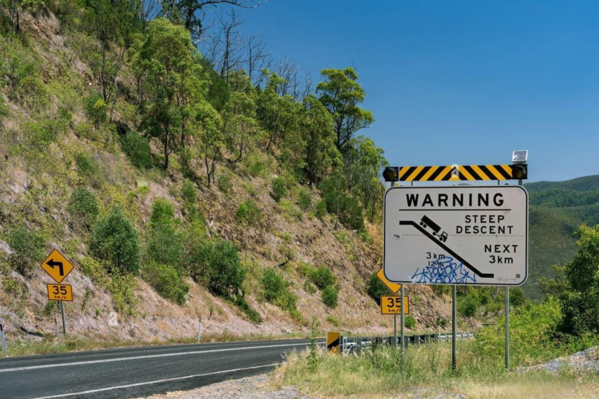
According to National Heavy Vehicle Regulator (NHVR) released an urgent national alert about steep descents across Australia that expose heavy vehicle operators to deadly conditions.

Fatal crashes, together with almost catastrophic accidents, show that steep slopes require absolute compliance with protective measures.

According to the NHVR, proper safety measures remain vital during operations in demanding conditions.

Recent Incidents Highlighting the Dangers of Steep Descents

Death-causing accidents from heavy vehicles increasingly occur at New South Wales locations Bulli Pass and Mount Ousley. Two fatal crashes during the previous year at Bulli Pass led to multiple deaths with serious physical injuries.

The truck encountered control troubles before breaking through barriers at a backward curving slope on the mountainside.

Data shows that truck drivers now use safety ramps and arrester beds, which have successfully prevented major trucking accidents.

NHVR’s Safety Recommendations upon Steep Descents

According to the NHVR, drivers must follow steep descent warning markers and then select the gear to lower before initiating a sloping descent. The approach protects control systems by lowering brake operations and stopping heat buildup.

New South Wales truck and bus drivers must follow regulations that require them to use gears suitable for controlled speed maintenance instead of principal brake operation.

Repeated heavy use of brakes results in excessive heat generation, causing decreased performance of brake mechanisms while simultaneously elevating the potential for vehicle accidents.

Importance of Vehicle Maintenance and Driver Training

The safety of all driver operations depends on frequent inspections combined with regular maintenance work on braking systems.

Drivers experience significant impairments in stopping ability when their brakes do not operate correctly, mainly when they should make urgent stopping stops.

A vital part of operator responsibility includes driver training to safely handle steep descents as well as warning them about safety risks during these routes.

Route allocation decisions must carefully take into account drivers’ driving abilities and experience when they handle difficult descent sections.

Planning and Preparedness Ahead of Steep Descents

Safety depends on the effectiveness of planning journeys. After considering steep descents, all drivers need to schedule proper rest stops to maintain attention levels.

Through early knowledge of dangerous areas such as Bulli Pass, drivers can develop heightened caution levels.

Sticking to road signs on the one hand and following directions on the other while maintaining strict speed limits set up an essential safety protocol for protecting everyone using the roads.

Read More: Heavy Vehicle Detours: Updates Near Wallendbeen Bridge

Enhancing Road Safety on Steep Descents in Australia with Fleet and Compliance Software

Steep descents in Australia present significant challenges for heavy vehicle operators. Recent NHVR alerts highlight the core importance of correct equipment operation alongside vehicle upkeep, complete driver education, and detailed planning steps for routes.

The accident-prevention capabilities of Manage Vehicle’s advanced fleet and compliance software are essential for any safety strategy.

The systems evaluate vehicle speed combined with brake system activity and driver fatigue levels in live operation to notify fleet administrators about dangers that are beginning to intensify.

When drivers use these safety measures to handle dangerous geographic conditions, they achieve safer journeys, reduced accident probabilities, and more substantial road safety outcomes.

The reduction of risks for steep descents depends on safety protocols, vehicle maintenance, and driver readiness preparation.

The system combines our fleet and compliance software to improve safety because it tracks driver routes and speeds and sends immediate maintenance messages.

Discover: Why Driver Fatigue Is a Serious Risk for Transportation Businesses

Why Choose Manage Vehicle’s Fleet and Compliance Software?

The NHVR’s proactive stance serves as a critical reminder of the responsibilities shared by drivers and operators in ensuring the safety of Australia’s roads. Our fleet and compliance software alerts drivers to potential near-fatal accidents while descending.

Your fleet business advancement is now reachable through our current SaaS solutions. Talk to us right now about our modern fleet management software that will modernize your operations and protect your safety and compliance.

Contact us right now to utilize our state-of-the-art SaaS solutions, which will revolutionize your fleet operations.

Heavy Vehicle Detours: Updates Near Wallendbeen Bridge

Truck drivers require urgent route modifications to bypass the Wallendbeen Bridge area because recent structural damage has created major heavy vehicle detours problems near this location.

Static detours need complete understanding to prevent disruption of efficient supply chain operations and protect active security.

Heavy Vehicle Detours: Current Status of Wallendbeen Bridge

A December 2024 truck collision destroyed the Burley Griffin Way temporary one-lane bridge at Wallendbeen, permanently shutting it down.

The bridge underwent installation in October 2021 to serve as an emergency replacement after severe weather struck the primary structure.

Freight transportation has suffered a significant disruption since the bridge closure limited access from the Hume Highway to the Olympic and Newell highways.

Designated Detour Routes for Heavy Vehicles

Officials implemented designated detour paths for heavy traffic vehicles when they shut down the route. An official detour route takes truck operators from Wallendbeen to Stockinbingal through Cootamundra.

Vehicle traffic operating at Higher Mass Limits (HML) of 26 meters can use the Olympic Highway together with Silo Road through this designated detour route.

How Does Heavy Vehicle Detours Impact on Freight Operations?

The set detour routes have caused both longer trips and higher operational expenses for freight transportation businesses. Each deviation enforced by L & M Transport caused a 30-minute delay per journey that strained operating times and elevated fuel costs, according to Louie Pittari.

Operational challenges intensify in harvest seasons because quick delivery remains essential.

Also Read: Why Driver Fatigue Is a Serious Risk for Transportation Businesses

Community and Industry Response upon Heavy Vehicle Detours

Long-term highway closure, together with the utilisation of temporary measures, has caused resident dissatisfaction and business frustration in the affected areas.

State Member for Cootamundra, Steph Cooke, has elaborated on the permanent replacement project’s lack of progress over time while highlighting the worsening difficulties sustained by local farmers and residents across extended harvest cycles.

Why are Heavy Vehicle Detours Essential in Australia?

Our nation confronts repetitive heavy vehicle detour alerts because of both maintenance requirements and physical infrastructure repairs and developmental work.

South Australian officials face criticism for the Roseworthy roundabout due to its unsafe design, which makes large vehicles choose alternative routes at more significant financial expense.

The Bruce Highway closure after a truck accident resulting in an explosion in Queensland produced major freight flow disruptions that revealed the necessity of sound emergency planning systems.

Authoritative teams paired with proactive infrastructure maintenance enable the heavy vehicle industry to avoid detours that preserve uninterrupted national goods transport.

Do You Know? Transportation Management Software: How It Optimises Logistics?

Australian Government Unveils New Rest Stops for Truck Drivers

New rest stops are opened to truck drivers by the Australian Government, ensuring the long-haul routes are safer and more comfortable. This initiative promises better development of infrastructure for the road transport industry.

There are new rest stops emerging with increased demand for better facilities addressing preeminent challenges. What does this mean for the future of road safety? Stay tuned until the end.

Truckies can Take a Load Off at New Rest Stops

The Australian Government, in a steadfast commitment to road safety, is making significant strides to ensure all truck drivers and all road users are safe. The announcement of six new projects under the fourth HVRA round shows this plan in action.

These projects are part of a $17.4 million joint investment between the Federal and state, territory and local governments, with the Australian Government contributing $9.7 million.

The HVRA program has $140 million in federal funding over 10 years to build and upgrade heavy vehicle rest areas, address the shortage of rest stops in key locations, and improve road safety for large and small fleet drivers.

Trance Four Projects: New Rest Stops Across Australia

Projects funded under tranche four include new rest areas with toilets and picnic areas, resurfacing, line marking and bitumen sealing. The funded projects are:

  1. Maranoa Shire Council, Queensland: Resurface the heavy vehicle truck stop at the Roma Truck Stop Area.
  2. Queensland: Design and build a new heavy vehicle rest area at Homestead West on Flinders Highway.
  3. Narromine Shire Council (NSW): Upgrade Tomingley heavy vehicle rest area.
  4. New South Wales: Upgrades to Ravensworth Eastbound and Westbound rest areas on Sturt Highway.
  5. Yarriambiack Shire Council (VIC): Upgrades to nine existing truck parking bays in the Yarriambiack Shire.
  6. South Australia: Stuart Highway Rest Area Upgrade at Arcoona and new heavy vehicle rest area at Pimba.

“These are just another example of the Australian Government’s commitment to driver safety and the road transport industry,” said Heavy Vehicle Rest Area Steering Committee Chair, Senator Glenn Sterle.

Mr. Sterle further said, “I am pleased the Heavy Vehicle Rest Area initiative is delivering heavy vehicle user safety and productivity through new and upgraded rest areas.

We are committed to keeping our freight operators and communities safe. These new and upgraded rest stops will help truckies manage their fatigue as they do their job of keeping our country moving.”

Now Trending: How E-Commerce has Changed Logistics Industry in Australia?

One of the New Rest Stops Replacing the Old ‘Dust Bowl’

After the ‘Dust Bowl’ on the Hume Highway at Menangle, NSW, was closed nearly a year ago, construction has started on a new rest area for truckies.

The Dust Bowl, an unofficial parking bay and rest area, was closed in February 2024, much to the dismay of truckies.

Transport for NSW (TfNSW) has now started building a new oversized, overmass and heavy vehicle rest area on the northbound side of the Hume Motorway at Menangle, opposite the Partridge VC Rest Area.

“We have promised truck drivers hard-working truck drivers that facilities and options in and around Sydney will get better,” said Minister for Roads John Graham.

Mr. Graham also said, “By replacing the informal Dust Bowl rest area, we are providing a safer place for truckies to stop, park and stage their long hauls.”

The construction team expects to finish the site by the end of June 2025, weather permitting. According to TfNSW, the new rest area will also feature safety installations such as acceleration and deceleration lanes. The Moolgun Creek stopping area will remain open for OSOM drivers during this time.

Work will be done between 7 am and 5 pm, Monday to Friday, from January to March. An 80 km/h speed limit will apply through the Hume Motorway construction zone during standard hours, 40 km/h near live traffic or during night work.

Furthermore, Mr. Graham said, “Northbound lanes will close for concrete barriers and line marking, with a 3km contraflow to keep traffic moving. Thanks for your patience!”

It is one of many projects Transport is doing to improve heavy vehicle facilities in Western Sydney, including our promise to deliver a new Western Sydney rest stop. We’ve listened to industry feedback and are looking at six potential sites for the new rest stop,” Graham said.

Joint Media Release upon Kyeamba Gap Work Rest Areas Upgrades

Drivers can look forward to seeing significantly improved rest stop facilities on the Hume Highway between Tarcutta and Holbrook. This month, work will commence on the Kyeamba Gap Work Rest Areas, promising a better experience for all road users.

A $1.8 million investment from the Albanese and Minns Labor Governments will see the northbound rest stop’s composting toilet replaced with flushing toilets, disabled access, and improved lighting.

The southbound rest stop currently has only bins and will have a new toilet block with disability access.

Both rest stops will have new lighting and extra parking for heavy vehicles. Work will start on the northbound rest area first and will be finished by March 2025, weather permitting. To reduce inconvenience, we will be installing portable toilets for everyone’s use.

The southbound rest area will be closed later in 2025, and alternative rest areas will be available at North Billabong (southbound) and South Tarcutta (northbound).

The team expects to finish the site by the end of June 2025, weather permitting.

They will permit property access during construction work. They will also install safety measures like ropes, fences, and signs. The measures ensure that all drivers maintain safety during the upgrading process.

Leaders Support on Upgrading Kyeamba Gap Rest Areas

In a statement, Senator Anthony Chisholm told, “these will make a big difference to drivers and truckies on the Hume Highway with toilets now open, new lighting and more parking.”

During the interview, Jenny Aitchison, NSW Minister for Regional Transport and Roads, stated, “Driver fatigue is one of the top three causes of fatal crashes on NSW roads. These projects will improve facilities and encourage drivers to rest.”

Dr Joe McGirr, one of the NSW members for Wagga Wagga, also said, “Factor rest into every journey. These Kyeamba Gap rest stops are a reminder to drivers to stop and refuel before you go.”

Explore More: Very Large Transport Operation on the Move: Avoid Area for Safety

Very Large Transport Operation on the Move: Avoid Area for Safety

Do you know about a very large transport operation on the move in Victoria? If you haven’t heard about it, then let’s take a glance right now.

Wherever you drive in Australia, you cannot miss seeing a truck with an oversized load. It could be moving an old house from one place to another, moving equipment into the mines or construction sites, or moving gigantic turbines for some wind farm.

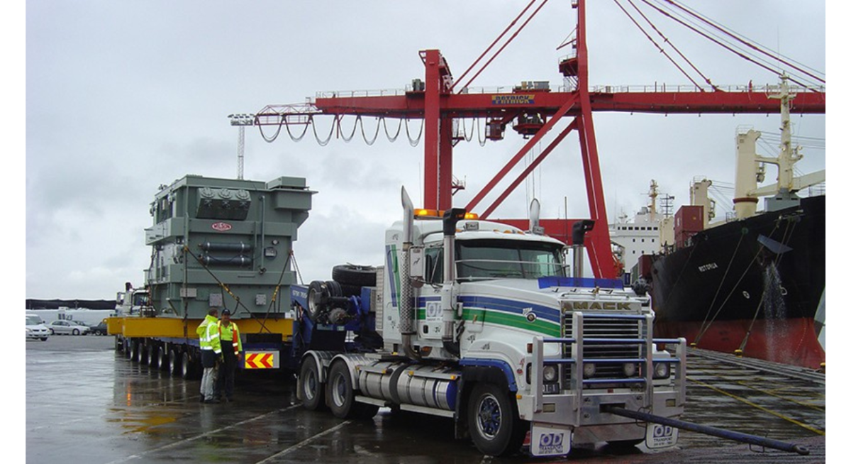
A vast power transformer leaves Appleton Dock, Port of Melbourne, at 11 pm on Tuesday, 14th January 2025. It will reach Plumpton by 5 am on Wednesday, 15th January 2025.

The length of the heavy vehicle is about 78 metres long, and its width is about 4.5 metres wide. Moreover, it is suitable for transporting the transformer.

Staying at a safe distance when the load is travelling or parked is the best way to avoid a mishap since this is quite a tricky operation. If driving out is necessary during this time, plan to ensure a scarce source of delays or take another route.

The Journey of Very Large Transport Operation on the Move

As part of the transport operation, escort vehicles and co-driver teams will follow closely. They will escort the load at the front and behind the car to ensure road safety during and after the move. It will be travelling at night to mitigate the impact on the road network.

For taking a ride in transport, the average speed is 45 kilometres per hour. Meanwhile, there are circumstances, especially when crossing bridges and corners, and they have to further slow down to around 5 km/hr.

For a brief time, a temporary road closure will occur from Sunshine Avenue between Rutherglen Way to Santa Monica. Moreover, it is vital for the time taken for the heavy vehicle to negotiate a tight roundabout within the vicinity.

Ensuring Road Safety during a Very Large Transport Operation on the Move

Transport operations will be running at significantly reduced speeds. Plan for the travel in advance and allow extra time. There will be some places where traffic police will supervise the underpass.

When you notice a pilot or an escort vehicle equipped with “Oversize Load Ahead” signage and yellow flashing lights, slow down and move as far to your left as possible. All drivers should prepare to stop after receiving any instructions.

If you are coming from the rear, slow down and wait for the transport operation. You will be able to overtake it again when it is safe to follow through.

You can only overtake when instructed to do so. Do not overtake the pilot or escort vehicle, juncture the load, and get stuck in between. It makes it difficult for everyone to do an efficient job, and you put yourself and others in harm’s way.

Also Read: How Much Do Truck Drivers Earn in Australia? Salary & Wages

Maintain Safety While Parking the Oversized Vehicle and Power Transformer

HVNL law says that you should not stop on a freeway to look at the load when it is parked, both for your safety and that of other road users. Stopping on a freeway is illegal and dangerous both for oneself and other road users, including passengers in one’s vehicle.

Victoria Police and the National Heavy Vehicle Register can impose penalties if caught. Moreover, there would be no opportunities for viewing. It is for everyone’s safety, including any children who may accompany you.

Plan Ahead of the Very Large Transport Operation on the Move

That’s a lot of arrangement. It involves a big crew of specialists in the transport, and their safety and your safety are the areas of focus. Kindly plan your trip earlier and stay away from the vicinity.

Visit the VicTraffic website for live travel recommendations; don’t forget to allow yourself plenty of flexible time to make it to your destination.

Explore More: Olympic Highway Accident: Truck Driver Charged in Riverina Crash