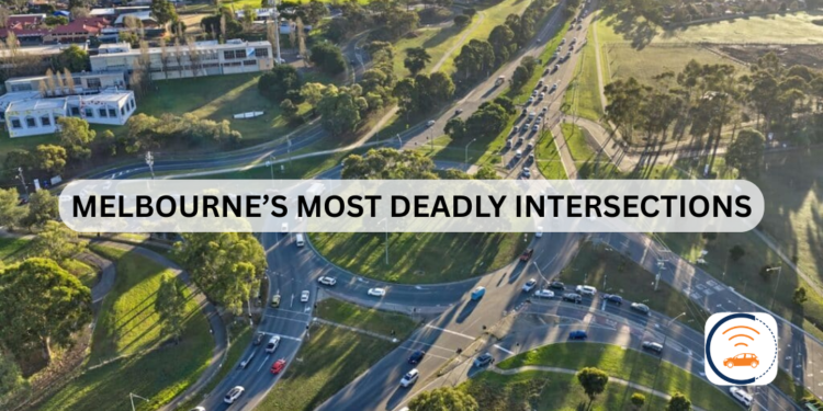
Melbourne Deadly Intersections: A Truck Driver’s Guide for Safety

For truck drivers, navigating Melbourne deadly intersections is a daily challenge that poses a significant threat to both safety and efficiency.

The RACV’s My Melbourne Road campaign surveyed over 12,000 road users. The results identified several key trouble spots across the city.

These locations are notorious for their complex designs, high traffic volumes, and confusing layouts that can lead to dangerous situations, especially for larger vehicles.

Your Guide to Melbourne Deadly Intersections

Before we detail the specific trouble spots, it’s crucial to understand why these intersections are so hazardous.

Experts and drivers identify these intersections where design flaws and traffic patterns create serious risks. So, knowing these spots helps truck drivers defend against danger.

1. North-Eastern Melbourne Intersection:

This roundabout presents a difficult multi-lane challenge on a slope. Also, its poor design often encourages risky and unsafe driving behaviours.

Melbourne Deadly Intersections
North-Eastern Melbourne: from Greensborough Bypass and Diamond Creek Road Roundabout in Greensborough is the most dangerous intersection. | Image Source: Nearmap

2. North-Western Melbourne Intersection:

A complex roundabout forms where Mount Alexander, Keilor, and Lincoln Roads meet. Henceforth, navigating it is made more difficult by turning trams in the busy centre.

Melbourne Deadly Intersections
North-Western Melbourne intersection includes Mount Alexander Road, Keilor Road and Lincoln Road in Essendon. | Image Source: Engage Victoria

3. Western Melbourne Intersection:

The Western Freeway ramps at Hopkins Road feature an unsignalised intersection. Moreover, this design forces conflicting right-turn traffic into dangerous crossing paths.

Melbourne Deadly Intersections
Western Melbourne Intersections from Western Freeway On and Off Ramps at Hopkins Road is one of the most dangerous intersections in Victoria. | Image Source: Moving Melton

4. Eastern Melbourne Intersection:

The junction of Mountain Highway, Wantirna Road, and Boronia Road is plagued by high speeds and difficult turning movements. So, compounding this is its unpredictable traffic signal timing.

Melbourne Deadly Intersections
Eastern Melbourne Intersection is facing issues with high speeds, complex turning points and inconsistent traffic signals made it deadly for truck drivers. | Image Source: Bicycle Network

5. Inner South-Eastern Melbourne Intersection:

Drivers at Dandenong and Warrigal Road face a double threat. Furthermore, the intersection features dangerously short slip lanes and inadequate green light time for right-hand turns.

Melbourne Deadly Intersection
Inner South-Eastern Melbourne from Dandenong Road (Princes Highway intersection is deadly for vehicles to turn right and short slip lanes. | Image Source: Real Commercial

6. Outer South-Eastern Melbourne Intersection:

The complex convergence of Princes Highway, Springvale Road, and Centre Road in Springvale causes severe intersection queuing and low visibility. So, this creates a high-risk environment for all road users and pedestrians.

Melbourne Deadly Intersections
Outer South-Eastern Melbourne from Princes Highway/Springvale Road faces low visibility, over-speeding and deadly for pedestrians. | Image Source: VicTraffic

7. Inner Melbourne Intersection:

The intersection at Flemington Road and Racecourse Road is a major traffic bottleneck. Similarly, drivers must maintain constant vigilance for trams, cyclists, and erratic behaviour from other motorists.

Melbourne Deadly Intersection
Flemington Road creates interaction with trams and bike riders; traffic build-up with driver behaviour. | Image Source: HUON

For truck drivers, the first step to safety is awareness. So, knowing these hotspots helps mitigate the dangers they present.

A Call for Action: Urgent Investment Needed for Safer Intersections

More than 12,000 Victorian drivers voted to name Melbourne’s most dangerous and frustrating intersections. So, RACV is now urging the government to take immediate action.

“We know that around 40 per cent of crashes in Melbourne occur at intersections,” stated RACV Head of Policy, James Williams.

Melbourne Deadly Intersections
RACV Head of Policy James Williams shares insight on regional road intersections in Victoria. | Image Source: 7News Melbourne

Mr. Williams also emphasised that to achieve the goal of halving road deaths by 2030,

“government needs to invest in fixing these intersections.”

Furthermore, RACV has provided evidence-based solutions for these high-risk locations. Fixing them is critical, as Williams notes,

“While improved driver behaviour and vehicle safety technologies are crucial, we will not reach our Towards Zero targets without investing in safer roads.”

The message is clear. Therefore, we need proactive investment to save lives and reduce daily driver stress across Melbourne and regional Victoria.

Here’s How Manage Vehicle Tackles Melbourne Dangerous Intersections

While you can’t change dangerous road designs, you can change how you navigate them. Moreover, Manage Vehicle app empowers truck drivers with smarter tools, using advanced route planning to identify and avoid known dangerous intersections.

Manage Vehicle Software Tackling Melbourne Deadly Intersections
Manage Vehicle Software improves route optimisation and real-time location tracking. | Image Source: Trinetra

Real-time tracking provides live updates on traffic and accidents, allowing for dynamic re-routing away from trouble spots. So, this gives you greater control for safer, more predictable road operations.

Navigate smarter and safer. Start your 30-day free trial of the Manage Vehicle app today.

Melba Highway Closure: Landslip Repairs Cause Major Delays

Melba Highway closure will disrupt commuters and freight operators for months as major repairs to two landslips are now underway, with the project expected to continue until the end of January 2026.

Earlier this year, from approximately February 17 to the end of March 2025, a section of the Melba Highway was closed due to landslip repairs in Dixons Creek. The affected area was located between Healesville-Kinglake Road and north of Hunts Lane.

During that closure, detours were established to guide different types of vehicles. Light vehicles, rigid trucks, and buses were diverted via Healesville-Kinglake Road and Healesville-Yarra Glen Road.

Melba Highway Closure: Major Landslip Repairs Until 2026

A single lane of the Melba Highway in Dixons Creek will remain closed until the end of January 2026 as crews work to repair two landslips that have caused major damage to the highway’s foundation.

The works, which began on Monday, October 13, are focused on a 130-meter section approximately 3km south of the Healesville-Kinglake Road intersection.

Melba Highway Closure Map
Two landslips have caused a major damage to the Melba Highway. Authorities have told commuters to take another route for travel and work. | Source: DoTP

The repair work involves a multi-stage process to stabilize the road:

  • Excavating and removing the damaged road pavement
  • Building new retaining walls
  • Reinstating and stabilising the road asphalt layers
  • Improving drainage to prevent future issues
  • Reinstating safety barriers, signs, and line marking

Early Works Trigger Melba Highway Closure and Reduced Speed Limits

From Monday, October 13, to Friday, October 31, crews are conducting early works, setting up the site and carrying out excavation and drainage work. During this period, motorists will encounter the following conditions:

  • Lane Closure: One lane will be closed during work hours (7am to 6pm, Mondays to Saturdays) over approximately 100 metres between Healesville-Kinglake Road and Hunts Lane.
  • Traffic Management: Temporary traffic lights and on-site traffic controllers will be in place to manage flow.
  • Speed and Delays: Reduced speed limits are in effect, and drivers should expect delays of around five minutes, with longer waits during peak times. The road reopens to two lanes outside of work hours.
Melba Highway Closure Due To Landslip Repair Works
Melba Highway Closure due to Landslip Repair Works at Dixons Creek; Here’s a Detour Route for Light Vehicles. | Source: Transport Victoria

In a welcome relief for holiday travel, crews will complete early works before the Melbourne Cup long weekend. Both lanes of the Melba Highway will be open from 3pm Friday, October 31, until 7am Wednesday, November 5.

24/7 Melba Highway Closure from November 5 as Major Works Begin

After the long weekend, from Wednesday, November 5, until the end of January 2026, the repair project will intensify. Crews will work on both landslips simultaneously, leading to more extensive traffic conditions.

  • The project will maintain a single lane closure at all times over a 200-meter stretch.
  • Temporary traffic lights will operate 24/7 to manage two-way traffic.
  • Traffic controllers will be on-site during work hours, and reduced speed limits will remain for safety.
  • Drivers should continue to expect delays of approximately five minutes.
Melba Highway Closure Beyond North of Yarra Glen
Previously, two landslips already happened in Melba Highway to close from Kinglake to Dixons Creek in February 2025. | Source: Victorian News

Works will pause for the Christmas and New Year period under changed traffic conditions, with further updates to be provided by the Department of Transport and Planning (DoTP) as the project progresses.

Navigate Highway Disruptions with Manage Vehicle

For transport and logistics companies, unexpected road closures like those on the Melba Highway can cause costly delays and disrupt delivery schedules.

Manage Vehicle app helps fleets navigate these challenges by providing real-time alerts for highway closures and traffic disruptions, allowing for dynamic route optimization.

With features like smarter transport management and real-time tracking, the system guides drivers to the most efficient paths. This saves valuable time and fuel by helping them avoid unexpected roadblocks.

Give your fleet the advantage of foresight. Try the Manage Vehicle app today and transform the way you navigate route disruptions.